This continues our series of photoessays on days spent hiking in largely unspoilt National Park and Nature Reserve areas on the South Coast of Western Australia – the places which escaped the bulldozers of the white settlers and are still clothed in the original Australian ecosystems that go all the way back to Gondwana. The South Coast is a biodiversity hotspot and has truly amazing flora and fauna. Walking in these areas teaches us about who we really are – one species among many, in an intricate and complex web of life we destroy at our own peril.
I use the term “wilderness” with caution here. My own definition of that word was always about places that had not been spoilt by humans, where nature was present in fullness and abundance. Australian Aboriginal people call this “country” and before European colonisation, they actively managed these ecosystems for over 30,000 years, in ways that allowed them to live in harmony with nature rather than in battle against it. They say, “If you look after country it looks after you.” Permaculture folk think similarly, working on better ways to grow food in bulldozed places than broadacre monocultures run with agricultural chemicals and fossil fuels.
This episode continues with a special winter outing courtesy of a day of sparkling sunshine.
July 4, 2021
SUNSHINE AND SEASHORE
I’m super happy that we got a lovely day of sun and seaside walking to start off the weekend, in the middle of what is turning into a long, bleak winter. It was like an unexpected bubble of golden light and happiness in a sea of grey.
Here on Western Australia’s South Coast, we’ve had three years of drought (only 50-60% of normal annual rainfall) followed by one of the wettest winters on record – our region has literally been drowning for the last two months and large areas are affected by flooding, waterlogging, soil erosion, structural and landscape damage. There’s been a severe weather warning with sheep hypothermia alert at least once a week – normally we would get that once or twice a month in winter – and we’ve been regularly lashed with gale-force winds, sleet, and never-ending downpours. We live on a smallholding and I’ve been walking everywhere in gumboots for weeks. It was wet last weekend and it’s forecast to be wet again later this weekend and for most of next week. Just what we need – more rain when the whole place is like a giant bog.
We made a pact that if we got a bright sunny day on one of our days off, we’d go somewhere we’d never been and make a day out of it, and that’s exactly what happened. Having walked the Bibbulmun track from Albany to Denmark in day-walk sections several times over now, we bought track maps for Denmark to Walpole and north to Pemberton and the inland Karri forests, so we can systematically walk another 150km or so of the famous track in sections over the next couple of years. We got a good start to this fitness and sanity project by doing a 25km walk from Parry Beach to Boat Harbour and back in May – I posted some photos of the spectacular, pristine coastal scenery in this thread at the time.
West of Boat Harbour is a little settlement called Peaceful Bay which we’d never been to before, and that’s despite of the fact I’ve lived and walked on the South Coast for decades. It’s simply such a vast place that you can keep yourself busy just climbing every Stirlings and Porongurups peak every year and doing the dozens of short and day walks in the Albany-Denmark region over again. But the Bibbulmun track has got to be the best way to see the coastline from Albany to Walpole, properly, on foot and totally immersed.
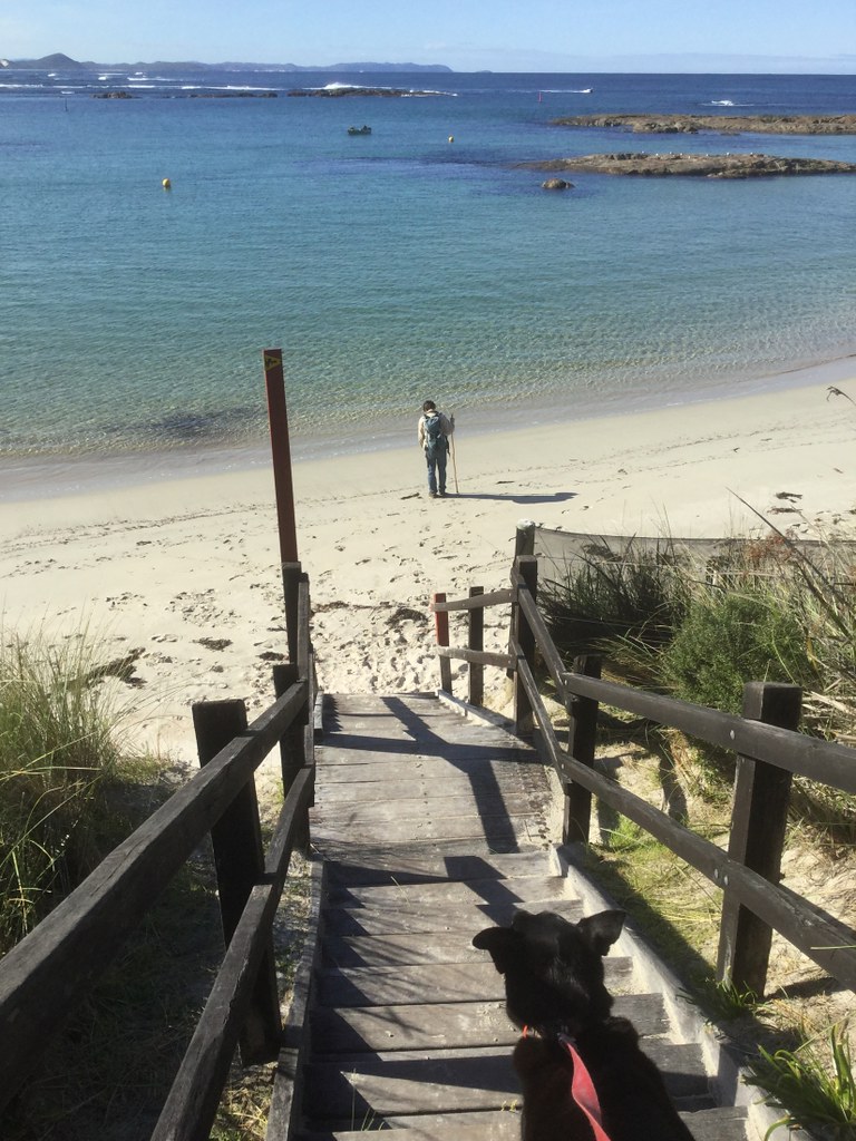
We’d warmed up for this big day out by doing a 10km hilly section locally on the Bibbulmun east of Bornholm on Thursday afternoon, and the hike we planned around Peaceful Bay was to go west around the seashore for about 7km and then shortcut back to the village via a 4WD track – about the same distance.
Fabulous outing. We started on the town swimming beach:
The end of that beach was a rocky cove:

From there on, we walked through a succession of beaches separated by dunes and rocky points. So this is the second beach, and you can see the next “up-and-over” at the end of it already:

Our dog loves to chase waves; here’s a nice photo of that:

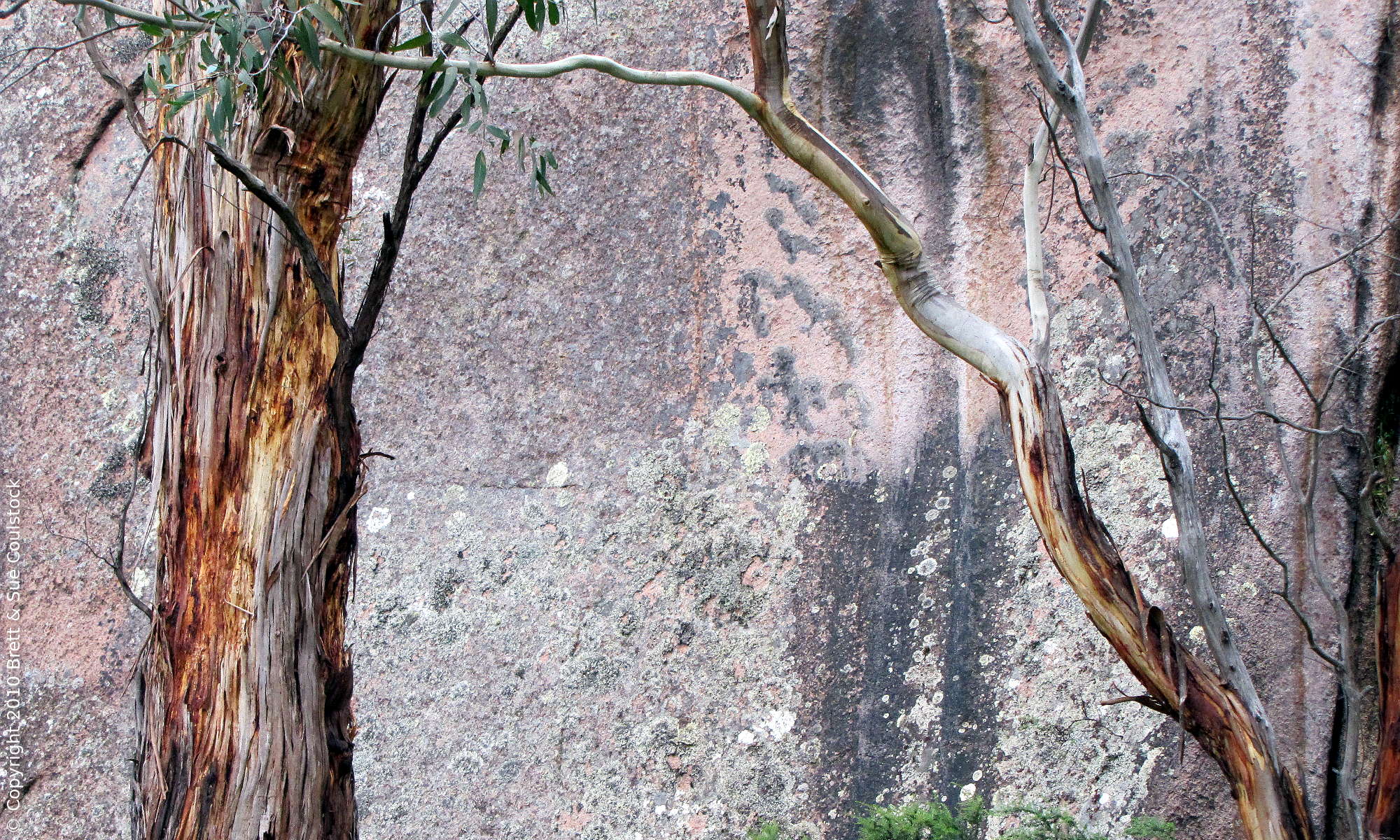
The geology of the Peaceful Bay area is mixed and diverse: Ancient granite, more recent intrusions of basalt etc, quartz veins, limestone, all creating a diverse and spectacular seascape:


The South Coast has a lot of very white, fine-grained icing-sugar sugar beaches from sand made of granite. On this walk, we also found cream-coloured beaches because of underlying limestone geology and the erosion of that. This particular little beach had much of its sand made of broken-down seashells:

We kept on following the shoreline, walking beaches and track…


The coastline in the distance behind Brett has the huge sand dunes behind Quarram Beach (we’ve not been there yet) to the left, and then the 12.5km Boat Harbour to Parry Beach stretch we did that return walk on in May, to the right of the photo.


From here, the climbs became more serious as we got into more elevated coastline:


Look closely at the next photo – there’s two kangaroos in it. They were less than 10m from the track and quite unconcerned with us as long as we kept walking!

The track got increasingly elevated, and there were quite a few sculptural-looking rocks around.

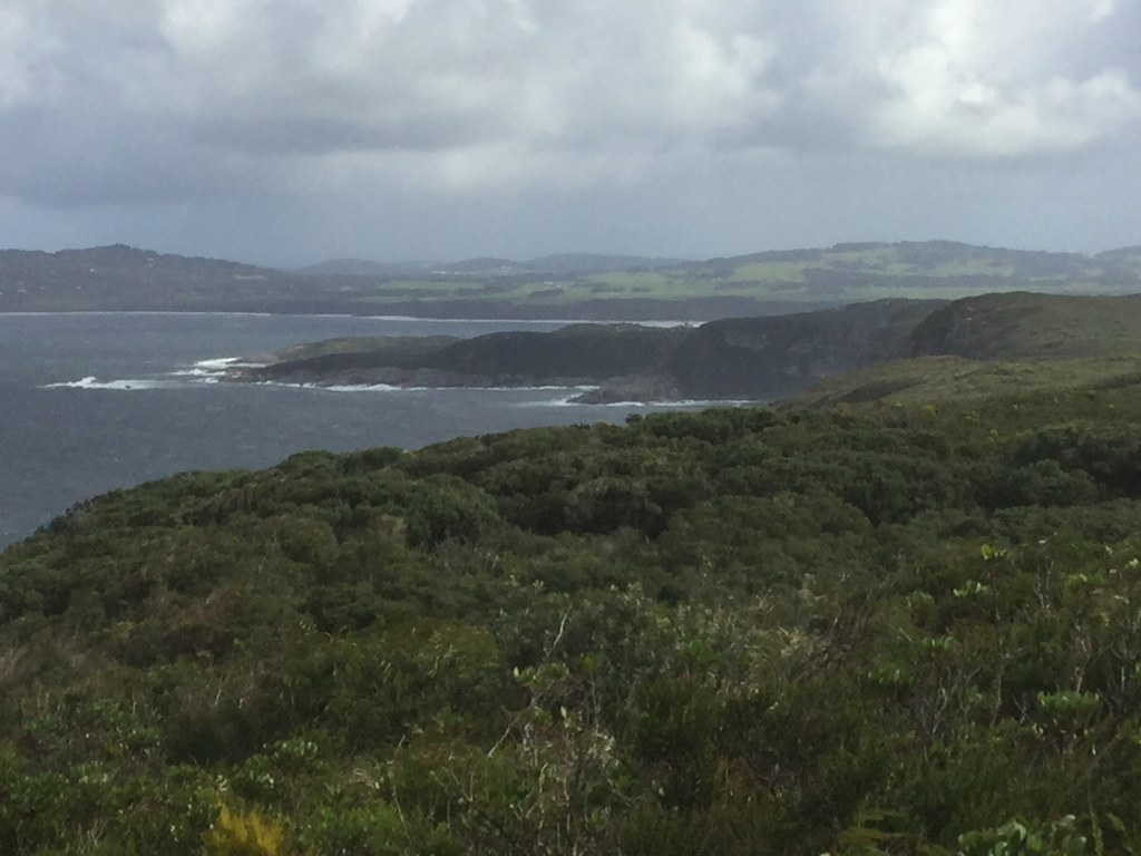
This is the coastline west towards Rame Head and Conspicuous Cliff.

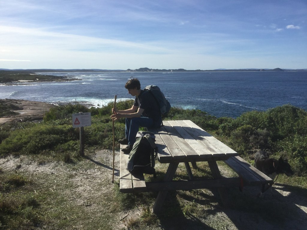
Quick snack stop – one thing I do quite religiously from two hours into a walk, to keep energy levels up…

More rock pools, and crabs!


A rounded-rocks shoreline:

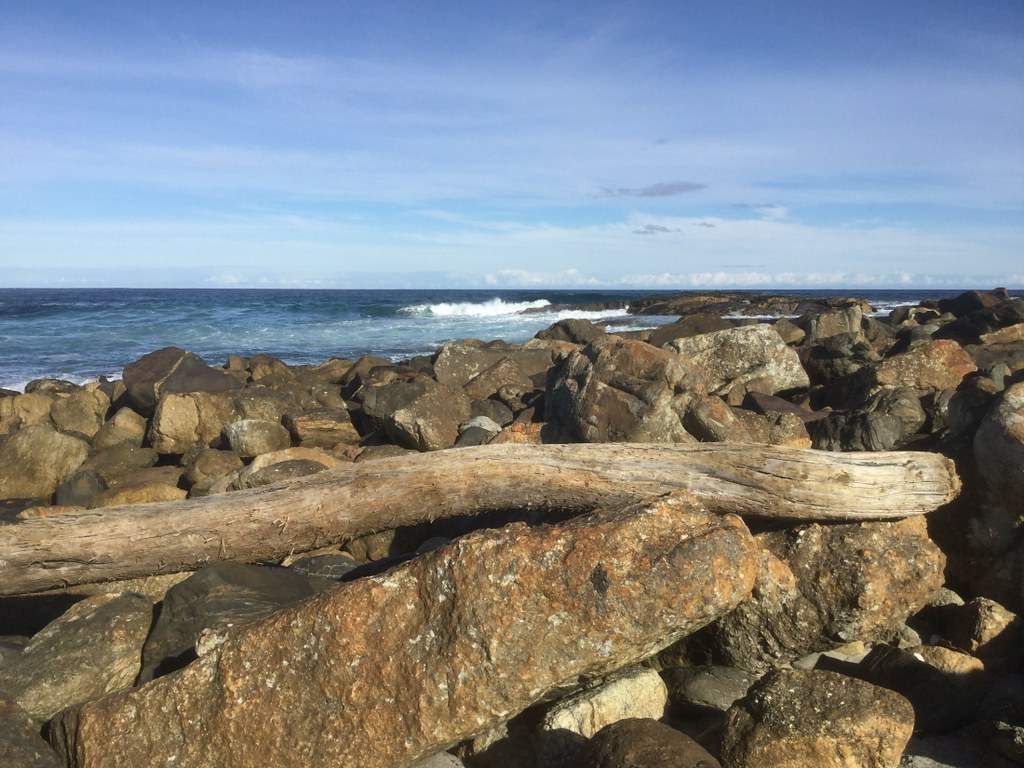
Imagine where this log came from, and how much power the sea has to toss it up on the shore like this:
This was entering a zone called The Gap:

There was a beach in this cove, at the end of which we sat down to eat and drink, before taking the 4WD track from there to shortcut back to Peaceful Bay village.

By this time my feet were feeling the walk, and Brett produced a pair of headphones from his backpack and invited me to listen to the music on his iPod, which I’d carried to take photos. I don’t normally do this, but I tell you what, a cover of “Blue Monday” by an outfit by the name of Orgy sure woke me up, and we made the 2.something km back in no time, despite the deep sand…

Peaceful Bay reminds me of a cross between Tasmania’s Dootown and the South Coast’s Windy Harbour – little informal villages of holiday houses, not built to suburban specifications – with a quirky feel to them.

Really good day out – and looking forward to more hitherto unexplored tracks, hopefully within the next fortnight.
To see all the photos and do a sort of “vicarious tour” just click here and then use the right arrow to go forward.
July 11, 2021
STORMY WALKING
The amount of rain we are getting is ridiculous – five fronts in one week, three of them associated with severe weather warnings. Well dammit, we’d had enough of being indoors and yesterday started the weekend by going out out to walk 15km (Muttonbird to Grasmere Wind Farm End return) as one of those fronts was approaching.
It felt so good to stretch our legs we walked merrily for three hours, through bursts of sun alternating with downpours and even sleet. What never stopped was the wind, which turned the 11 degree Celsius maximum into near-freezing due to wind chill. They don’t call’em the Roaring Forties for nothing…
The secret was to walk fast, and I’d had coffee, which tends to hypercharge me.
This is a sort of natural Stonehenge…there’s a few of them around the coast:

Views west to Grasmere and Albany Wind Farm…

A burst of sun… (…and spot the dog, who was ecstatic after mostly being on the sofa for two days…)

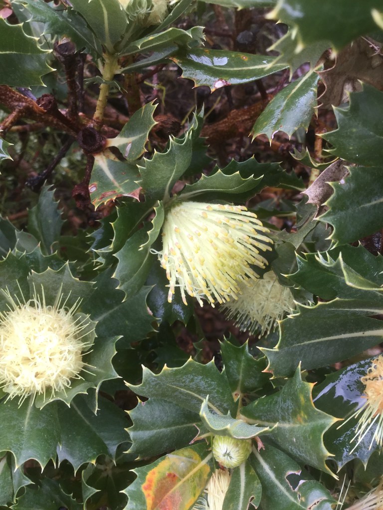
The heathland is starting to flower:

This is a Holly-Leaf Banksia:
Grasmere / Albany Wind Farm:

Happy dog, who can’t understand why we’re not always driving somewhere to go for a walk and then coming home to eat and collapse on the sofa (her favourite type of day):

Between coffee before walking, thermal mountain pants, a rainproof breathable jacket and walking fast all the way, I wasn’t too hot or cold:

Turning around on reaching the first Grasmere turbine, to return home:

Pretty spectacular cliffs, and Torbay in the background:
On the way back, we side-tracked to a campsite to shelter from a burst of sleet.

Of course, when we got to the hut the sleet stopped. We decided to go again a couple of minutes later, and within a minute, sleet was coming down at about a 45 degree angle on gales. The storm clouds were pretty impressive:

To see the full set of photos, click here and then use the RIGHT arrow to go forwards.
Another instalment soon.