August 4, 2021
EXPLORING PARRY BEACH TO POINT HILLIER
After days of soggy, horrible weather, we finally got a slightly better forecast and ventured out to Parry Beach an hour’s drive from home, for a day’s happy exploration of the local area. We still got wet on and off, but it was good to be out, in places that were completely new to us!
We’ve been to Parry Beach once before, but that was to do the 25km return walk to Boat Harbour back in May. The Bibbulmun track crosses Parry Beach Road slightly out of town, and 25km kept us plenty busy for the day, so we’d not had a chance to actually explore the immediate Parry Beach coastline.

You can see the Bibbulmun track in yellow/black, on which we headed westwards last time – and I’ve marked yesterday’s route in green, but it wasn’t straightforward, and we looped around and backtracked quite a bit. So I’ll break this walk into four sections to make it easy to understand.
Section 1: Coast immediately south of Parry Beach – stopping at hill
The first section took us from Parry Beach village south along the coast to the white sticking-out headland you can see on the map with the “D” shape in my green track line. That “D” is a very overgrown bush track around the top of a hill, and when things got hairy there (more on that later), we turned around and headed back to the village.
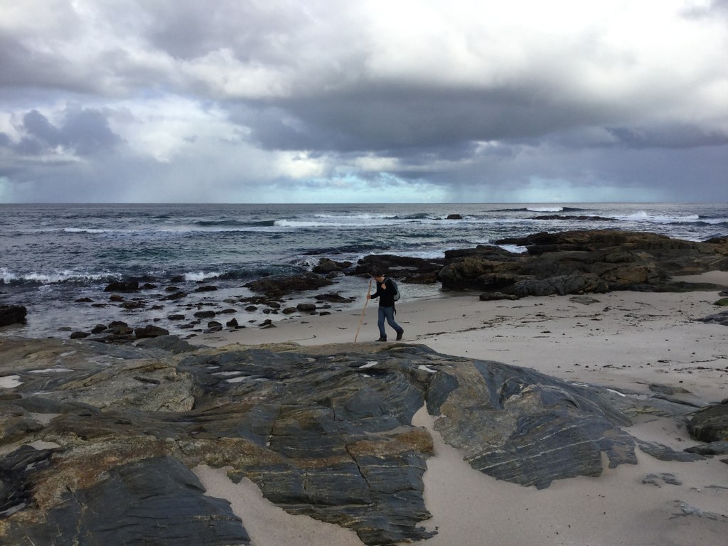
This is the village beach, looking north:

As we headed over the rocks due south along the coast, we met a very cute, very unperturbed sleepy seal.

Brett thinks it probably gets fed fish offcuts by the recreational anglers. Our dog had never seen a seal before and was incredibly intrigued, but I kept her well away on a leash so the seal wouldn’t get stressed.

Soon we reached the next beach, and Jess was able to devote herself to her wave-chasing hobby.

That hill in the distance is “the” hill we got stuck on, by the way. At the far end of this beach we had an early lunch – huge ham/cheese/avocado/salad sandwiches we’d brought from home. This was our picnic spot:

Note all the doggy footprints between us and the water – the dog spent time with us, then went out to chase waves, came back, went out again etc. We managed not to get rained on while eating. There were some striking sea sponges washed up.

After our meal, we headed south along the rocky shoreline, imagining we would be able to follow it all the way to the next beach, as indicated on the track map. 
There was nothing to suggest it wouldn’t be so – here’s a shot back as we began clambering.

We soon hit an area with really interesting, aerated volcanic rocks.


There were lots of crabs in the rock pools.

Soon after, the coastline became treacherous…

The waves were ramming into the shore, and the path passed too low for the weather conditions and swell to be safe. People get washed off the South Coast rocks and die on a regular basis because they ignore conditions like this. Later on I’ll show the area in question from the other side, complete with waves bursting over the shore.
We were unable to find an alternative route through the bush over the top of the hill, so we simply backtracked to the village.
We got rained on, and as the sun came out again we had a welcome break in a warm car, drying out our raincoats and backpacks outside and sipping hot tea from a thermos. Then we set out again, in a different direction.
Section 2: William Pinniger Trail & Hillier Beach South
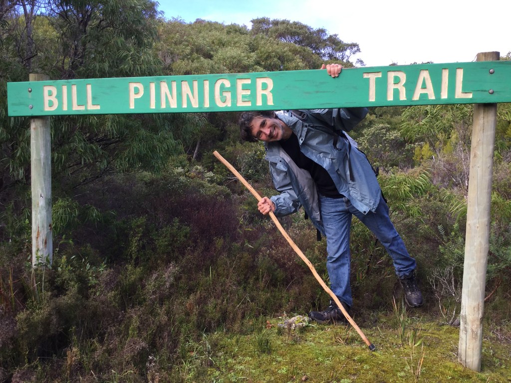
This time we walked west along the main road (red on track map) until we reached the William Pinniger Trail (red dotted line), which we followed to Hillier Beach.
This is not a creek, this is the actual track – it was flooded in sections, and we had fun trying to leap from edge to edge to keep to reasonable footing.

Hillier Beach:


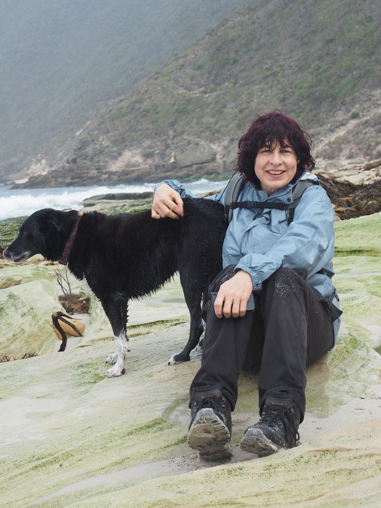
The dog loves hiking days.
Fabulous coastline…


Then we backtracked along the beach towards a path straight up!

Section 3: The Big Dune & Ridgetop Walking
…and I mean up…


Once on the ridge, we had to bushbash our way across to the ridgetop 4WD track (red on map). Brett was a bit suspicious of this process – I often joke that his middle name should have been Thomas. While he grew up in the wilds like I did, he’s a bit more civilised than me and more reliant on external compasses etc instead of instinct. So here he was, impudently playing air guitar at my person and informing me that the piece he was miming was called Watching Me Fall.

Alas, we soon found the track and the lookout named in Bill Pinniger’s honour.


Section 4: Hillier Beach North, over the hill and back to Parry Beach Village
The Pinniger Trail returned us to Hillier Beach again, spitting us out via this staircase:

You can see by the dog prints we did this twice – the first set fading on the left, the current set fresh on the right.

There was a lot of purple staining (from red algae) on one section of the beach.
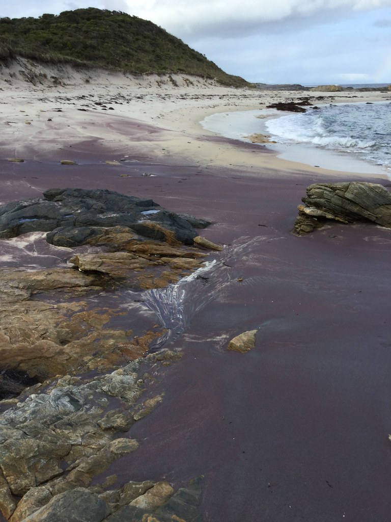
The views back towards Point Hillier reminded me of a glass artwork.

And so we made it back to the other side of the hill, with a clear view of the treacherous section of rocks we didn’t want to cross in these conditions.

At least from this side, we weren’t going to suddenly fall over a cliff, not knowing the local lay of the land. We could see where we’d have to round the hill.
This is the first of a series of nine photos I took closer-up of what exactly the waves were doing on that bit of coast.

To see the others, click on the above to get to Flickr, then press the right arrow to go forward. Brett says I should have taken a film at this point, but at least the pictures will give people an idea of the force of the waves – and these were normal waves for the day. You also get periodic rogue waves called king waves, which can be two to four times higher than the highest waves in “normal” sets in any given conditions…
So we went up and over instead.

…and finally found the connection to the beach we’d had our early lunch on, about four hours before.

That was a summary only – we have far more photos than I can cram into a post, of really beautiful things, and it has been painful to leave so much out. If you want to see the full set with lots more amazing stuff, here’s a slide show – and this one is highly recommended, it’s such an incredible place. Use the right arrow to got forward – photos finish with the dog in the back of the car!
We hope you have enjoyed another virtual guided walk on Western Australia’s remote and wild southern coastline. ♥
August 6, 2021
THE ROAD TO NOWHERE: OWINGUP SWAMP
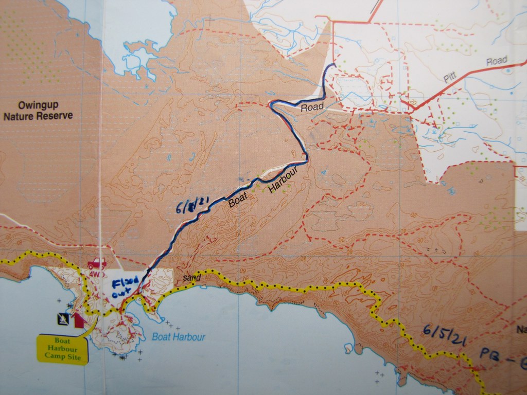
(Proffering map) “Look, Brett – this fine sunny day we could have a picnic lunch at Boat Harbour and the good look-around we didn’t get to have when we walked the 12.5km from Parry Beach in May and had to go back again before dark. There’s a road to it; the last 5km or so it says 4WD only. Some of that our car may be able to do and then we can just walk the rest, it’s not so far.”
What could possibly go wrong?
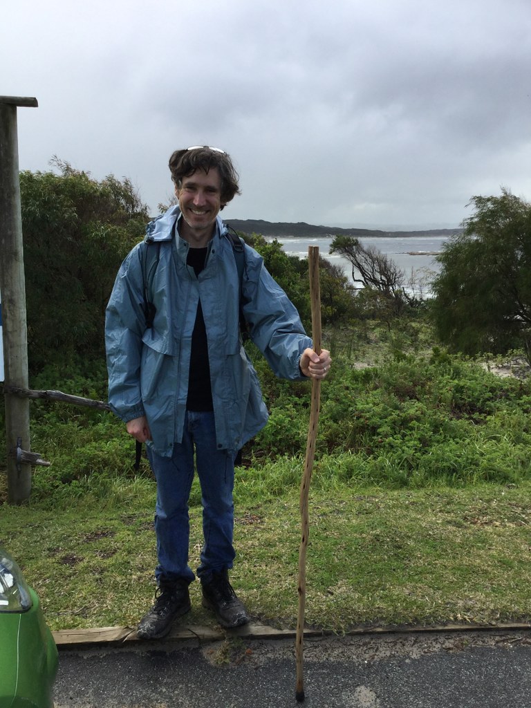
I’d made fish cakes and rice salad for the picnic, we had fruit and nuts and chocolate for snacks, and iced coffee and thermoses of hot tea. A nice way to finish off the holiday walking with the weekend forecast wet and windy again.
The 4WD track turned out non-negotiable for 2WD because sections were too soft and sandy, so we parked at the corner and started walking (marked blue on map).

It’s not as much fun to walk on vehicle tracks as on dedicated walk trails, because you’re not as “immersed” and because the footing is frequently loose, so it can be like walking on a beach, except it’s not a beach.
Nevertheless, we’d never been down this track before, and the Owingup Nature Reserve offers gorgeous woodlands, heathlands and wetlands, en route to spectacular Boat Harbour. Wildflower season is about to get into full swing – the bushes with white blooms in these photos are tea-trees starting to flower, and the yellow pom-poms are wattles (various Acacia species).


From halfway to our destination, we could see the ridge of dunes over which the Bibbulmun trail wends its way from Parry Beach to Boat Harbour – in this photo, the blue coastal ridge starting about one third of the way across from the left (the first third are wooded inland dunes).

There was a fair bit of water on the road itself; many corner puddles like this one, and some sections completely inundated. We made our way past those by diverting over the road banks.
If you look at the map, there’s seasonal wetlands marked in next to the 4WD track. To say that these were full is an understatement. Here’s a view west directly from the track:

It was those that broke banks and flooded the road at intervals. It’s just that time and again when the track looked like a creek or swamp for the next 50 to 100m, we were in luck with higher ground on the eastern roadside, and could clamber along there until the track was dry again.
And then we were nearly there. We could smell the ocean and hear the waves, and were looking forward to our picnic. The sign said Boat Harbour.

“Yay! In ten minutes we can unpack our picnic on the granite shores of Boat Harbour!”
But then there was this.

“No worries,” we thought. We’d done this half a dozen times in the past hour. Road underwater, but look at the dry verge on the left – just follow that along. Piece of cake.
About four fifths of the way along the photo, the dry verge ends at an intersection with another flooded track – this one in a valley, and more than thigh deep. We didn’t want to swim. I don’t have a photo from there because I literally had to hang off a peppermint tree to be able to see around the corner. Sometimes it would be useful to have tentacles, but because I don’t, there’s no photo.
So we backtracked to the place near which the last photo was taken, and had our fine picnic lunch there, on the bank next to the flooded track. It was lunchtime, we were starving, and we knew that our brains would think better after some nourishment was on board.
After increasing the blood glucose levels, I went back to the flooded intersection with the deep water to see if there was any way through the vegetation on the left to try a crossing further south – but the whole thing was a thicket.
I walked back along the bank testing the inundation depth with a stick. All of that section was at least knee deep. On getting back to where Brett and the dog were resting, I floated the idea that we might be able to roll up our pants, take off our shoes, and wade barefoot to see if a crossing was possible if we stuck to the right-hand side of the inundated road.
Brett wasn’t keen because he’d seen broken glass on the road, and the tannins in the floodwater make it impossible to see the bottom. We both remembered the scene in the specials for Lord Of The Rings where the hobbits ran into the water and Sam stopped as if he’d hit a wall and folded over. Because glass had come through the actor’s latex hobbit feet.
I remembered a middle school classmate when we were on an afternoon outdoor education excursion to the local weir to go swimming in the sweltering heat, running into the water and just collapsing. They pulled her out and her big toe was nearly sliced off from sharp glass thrown in by the kind of total idiots who do things in this world without caring about the consequences for others. I remember how pale and still she was when our teacher pressure bandaged her before the ambulance took her away.
I remembered how I used to run around barefoot and carefree myself as a teenager, cross-country, in the river, in the billabongs and farm dams. Until one day I stepped onto some splintering wood under the billabong surface, which embedded in my instep. That was a painful experience I never wanted to repeat.
Brett was right. While the chances of injury from a barefoot crossing attempt were small, the consequences of such an injury were prohibitive. We both had to be able to walk back; if one of us got incapacitated, we’d have to call in an emergency rescue team – since we have no 4WD ourselves.
So sadly, we had to turn back, but: Just perhaps, we’re going to add jelly sandals to our backpacks for future winter forays onto potentially flooded tracks.
I admit, going back was really anticlimactic. Road To Nowhere played in my head.
It was hot and the sun bit for the first time since April, there was no breeze, and the road was flat and boring. I cursed that – in keeping with Murphy – it was the very last flooded bit that had proved impassable, when we could already hear the ocean. To have come so far, and no scenic picnic – eating our nice food on a road bank next to a swamp.
And then I had a go at changing my attitude, so it wouldn’t spoil the outing. Because most of the eastern seaboard is in lockdown, and there are millions of people who would have given a lot to be walking this unspectacular-but-still-very-nice track on this fine, sunny afternoon with the blue sky and fresh air and the frogs croaking from the wetlands and the wildflowers starting to bloom, and a lovely dog and your best friend and life partner beside you.
We usually walk the Bibbulmun, or other coastal or mountain trails, all of which are like something from Tolkien, and it’s spoiling us, so that perfectly good scenery can bring on disappointment if we don’t watch ourselves. I know I’d cry if I went back to Europe, if I had to live in a city, if I had to live on the West Coast – because I have grown used to living at the edge of the wild, on a spectacular coastline, in a world biodiversity hotspot with ancient flora and fauna. And that’s exactly why I need to occasionally adjust my attitude so I can appreciate something non-Middle Earth.
So sometimes, being happy is about consciously looking for things to appreciate, in settings that don’t automatically make you go oooh, aaah. This is a good thing to practice – and it’s why people keep appreciation diaries, where they have to look for and acknowledge good things about their life on a daily basis. Not to put their head in the sand, but to pull it out, in a way – because often we don’t really look, don’t really listen, don’t really think about it, we take good things for granted, we don’t see all the possibilities in front of us, the things we could be doing this day that would add to the happiness of ourselves and others.
And about that 4WD track: Yes, it’s long and flat and sandy and comparatively boring, but we’ll be back – with mountain bikes, in the summer. We’ll ride in (getting off to walk the really sandy, churned-up sections) and this will make the journey in faster and more interesting. And then we can have that picnic at Boat Harbour, and perhaps even have a proper hike on a section of the Bibbulmun.

This is Boat Harbour, from a previous quick stop.

A context shot from slightly further east along the coast, of Boat Harbour and surrounds. Boat Harbour is the natural harbour in-between the two granite headlands in the middle distance.
August 4, 2021
MT HALLOWELL (AGAIN!)
We went back to Mt Hallowell, a regular haunt (see also here). Usually what we’ve done is to walk from Ocean Beach Road through the Mt Hallowell Reserve to Lights Beach Road, and then complete the loop on the road – which you can see on this map:

…so from the car symbol on the right-hand side of the map along the yellow track to the car symbol on the left-hand side, and back along the road marked in red. The road section is deadly dull to walk because it’s flat all the way around and, well, a road. So we had another idea: Just to walk to the top of Mt Hallowell, have lunch at the Kordabup lookout (triangle), and then simply backtrack. We’d actually never walked this track in the other direction before, so that was in itself a new experience!
We didn’t take many photos because we’ve documented this walk several times – just a couple at our lunch destination:


It was a really cold day here, a bit of a contrast to the spring weather we had all last week – the maximum was 13 degrees Celsius, but most of the time the apparent temperature hovered around 8 degrees. This is a good day to do uphill walking through a forested hillside – you don’t end up overheating. Also, in the forest you’re sheltered from the cold winds blowing on a day like today. But up at the lookout, the icy Antarctic wind blasted us and we cowered on this side of the rock in the pictures to eat our sandwiches and sip hot tea from a thermos, and didn’t linger after that.
Just to the left of Brett’s ear you can see Lake Williams, and if you look closely just under my left hand (right in the picture) you can just make out Hanging Rock which we walked to a while back (see here). The headland in the distance (just above and to the left of Brett’s head) is Point Hillier, which we also walked recently (see first entry above). It is exciting to start to recognise in the distance the places you’ve walked before, from a lookout point. But it was so cold and windy in that spot that we couldn’t even line the horizons up straight in a dozen attempts!
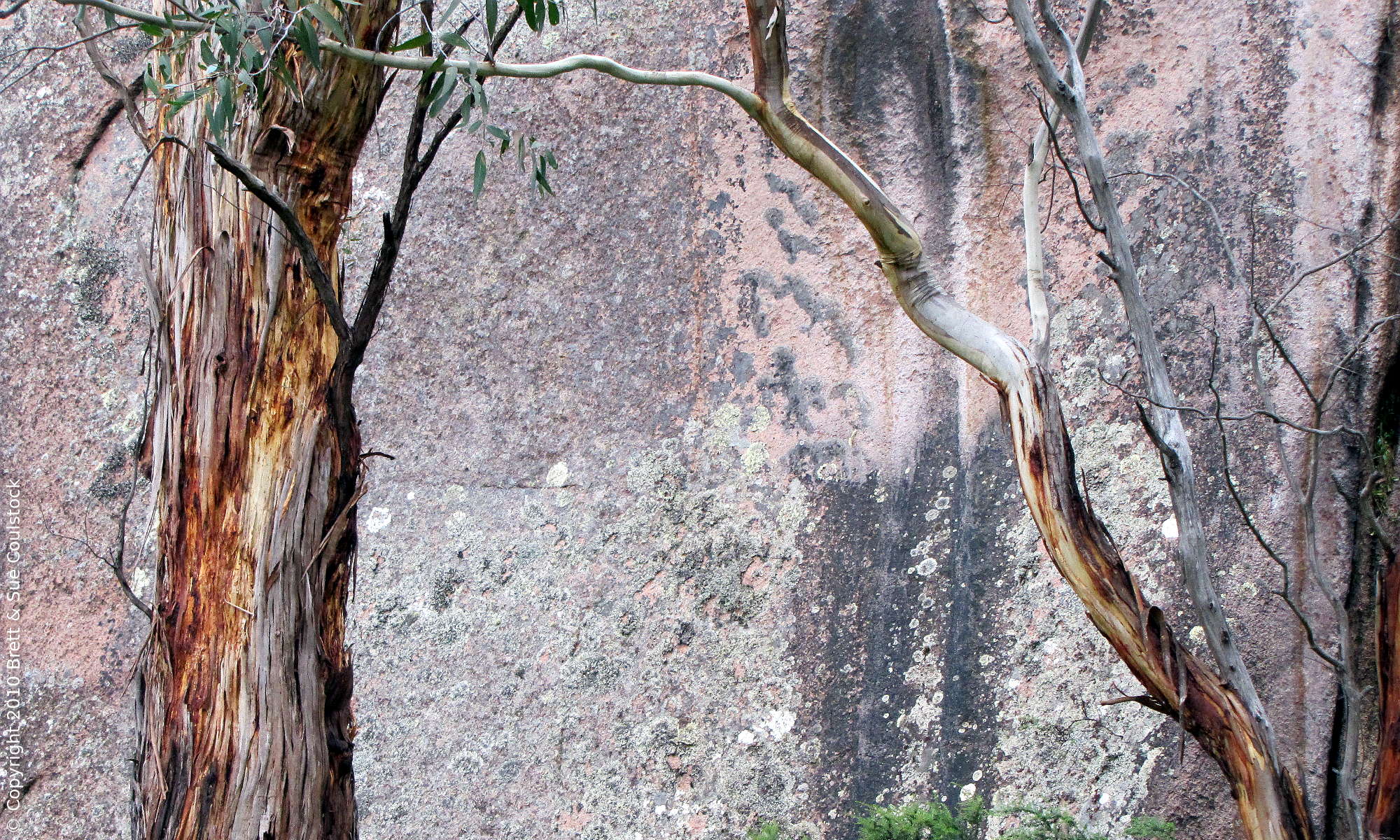
The walk back was mostly downhill, and we thoroughly enjoyed the different perspective. This is one of our favourite walks – it combines Karri Forest, granite monadnocks similar to the Porongurup Ranges (see here), and scenic views over the countryside and coastline.
Also it has a really impressive series of natural rock “castles” – one of which has an extensive cave in it (which you can see inside shots of in the links above).


Mt Hallowell provides an excellent all-body workout because of its considerable gradients, twisty-turny paths, uneven footing, boulder-crossings, obstacles, etc, so that you’re using muscles you never use walking on easy footing. All the while, the birds are singing, you’re surrounded by nature, the air is fresh and carries wonderful damp-earth, eucalyptus and other distinctive plant aromas, and you’re not having to put up with horrible music or other people’s sweat, unlike going to a circuit training class.

We had a really happy outing today – and we weren’t even exhausted after walking three hours, which was a bonus!